This inquisitiveness led to a strange discovery. In 1980s when I was posted in Rajasthan near the India-Pakistan border which was in the middle of the Thar Desert, an area devoid of any water source with not a blade of grass to be seen for miles. However, there was a small village named Sanu, approx. 65 kms from our location, which had an underground water source of sweet water; enough to meet the needs of half a lakh troops every day.
This amazing revelation and presence of Pakistan’s green belt at Rahim Yar Khan, a big city right across the border created that spark of inquisitiveness to learn more about this subject. The moment I turned to literature, I realized that this debate on the Bull vs Horse, the myth of River Sarswati, the invasion of Aryans and the Aryans vs Dravids, has been going on ever since the twin cities Mohenjodaro and Harappa were found by a group of archaeologists in the 1920s. Emotional biases can distort historical accounts.
Perhaps, had the Indians written their own history, such doubts would have never cropped up, but as we had lost our political freedom way back in 1192, such questions were bound to come.
The generations to come must realize that when the political freedom is lost, the vanquished forfeits the right to write their own history and it is the victor who then has the privilege to do that.
However, it is high time that we, the vanquished, start having a relook at our history ; not emotionally but with a scientific bent of mind. History I always felt need to be studied scientifically and in a holistic manner and not in isolation. It is time that we approach our history in a scientific and holistic manner instead of being stuck in the boundaries of politics and ideologies.
So, that underground water source at Sanu near Jaisalmer took me on a long journey to find an answer ;It is not claimed here that this is the only answer to this question and the author is an authority on this subject.
Challenge
These questions -Who were Indus people and did the Aryans come from outside India, have needlessly been politicized. These questions are so mired in politics and ideologies that often it becomes difficult for a layman who has a scientific bent of mind to come to a logical conclusion.
The Challenge answering them is not from the academic or research point of view but because of its politicization.
Till the twin cities ofMohenjo-Daro and Harappa were not found, it was propagated by the British and the English speaking Indians that the tall Aryans, fair complexioned, with long sharp noses, and broad forehead who were brave and warlike had come in hordes to India, defeated the natives and gradually settled down on this land and spread their culture. The dates assigned to this large scale immigration starting from2000 BCE to 1000 BC. Their main occupation was cattle rearing and farming and they were warriors.
Where is that Place ?
No one could, however, pinpoint the place from where the Aryans came. Some said the Aryans came from Central Asia while others said they came from Europe. Few scholars even tried picking up similarities between Vedas and the holy book Avesta of the Zoroastrians, to prove that Aryans came from outside the Indian subcontinent. Till date no credible evidence has been found to support this strand of theory, except the similarities of certain words. Even the DNA analysis has not proven that Aryans came from outside. So now it is said ; Aryans were not a race but a tribe. In that case many tribes were residing in this vast subcontinent.
Victims of Superiority Complex or Ideology?
Major Thorn in his memoirs ‘Conduct of War under Lakes’(page 499), has described in detail the British sentiments on the eve of signing an agreement with Yeshwantrao Holkar I on 7th January 1805 (Treaty of Rajghat) on the banks of River Beas described by Greeks as Hypahsis. He writes ;
“The British celebrated it as a historic moment. For them it was the fulfillment of the dreams of Alexander after a lapse of thousand years. Alexander on the banks of this river had erected 12 massy altars as the memorial of pride and conquest of a nation whom he would have called barbarous….The British after the lapse of many ages made the same river witness to the settlement of an honorable union….laying the foundation of an enlightened system which requires to be followed in the same spirit to prove to be advantageous to innumerable tribes scattered all over the region and to the great foreign power under whose fostering care alone they can keep the blessings of peace and civilization”.
As such, all the invaders including the Muslims from the West, thought themselves to be superior than the natives, burdened morally to civilize them, thus coming up with all kinds of narratives to justify their superiority. One may find the remnants of that sense of superiority amongst many such communities who have preferred to stay with the natives, whom they had once defeated.
What is astonishing is that despite the non availability of scientific evidence, many amongst the natives support this invasion theory, perhaps inorder to serve their own vested political interests or ideologies. Its difficult to answer on their behalf as there is no scientific evidence that Hordes of Aryans came.
Mohenjo Daro and Harappa must have taken them by Surprise.
Therefore, the findings of excavations in Mohenjo-Daro and Harappa, took the entire world by surprise. Mohenjo-Daro and Harappa (now in Pakistan) were discovered in the 1920s, along the river Sindhu and Ravi respectively. The discovery of such developed towns in this part of the world, dating 2800 BC – 1900 BC having wide roads, lanes and bye lanes cutting each other at 90 degrees, brick houses with attached toilets, pavements, sewerage system and elaboraterain water harvesting systems, took everyone by surprise. The British along with other Europeans could not believe their eyes.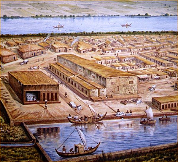
Let’s digress here a bit to discuss why we are addressed as the Indians.
A child is known by the name his parents gave and not by the name his neighbors gave him. So where have these names–India and dravid- come from. The westerners called us Indians and Hindustanis and thus, the names stuck. Our ancestors on the other hand called this land as Bharatam or Bharat.
The country (Bharatam) that lies north of the ocean and south of the snowy mountains is called Bhāratam; there dwell the descendants of Bharata."
—Vishnu Purana written in approx. Between 400 BC to 900 CEA.
Those who propagated this invasion theory, must have thought, how could the Indians set up such developed cities 4000 years ago when the whites were living like barbarians. So, was Aryan invasion theory a compulsion?If at all it was a compulsion, then why did our own people believe it?
What did they Do ?
Firstly, the proponents of this theory conveniently divided the history of our subcontinent into two civilizations - Sindhu and Vedic - so as to prove that this land has always been colonized by invaders.
Some historians even called Indus valley people as the earliest colonisers of India.
So the people who lived at Dholavira, Rakhigarhi etc were from Indus civlisation and those who wrote Vedas/Upansiahds, etc were Vedic who came subsequently and ursuped Indus people.
What are the Reasons for this Differentiation?
Sindhu civilization was urban which built cities had industry, artisans and exported finished goods whereas Vedic was a rural civilization who came later and developed agriculture.
So, where did those people who built cities vanished and from where did the Aryans come from?
The proponents had an easy answer. The Indus people were defeated by the Aryans, like the British and Muslims had defeated the natives of this subcontinent. After defeating the Indus people the invading Aryans thereafter moved to the east onto the Gangetic plains and thereafter the South.
Secondly, it was easier to exploit inherent differences of our physical features and divide the natives of this land. Perhaps the origin of these terms like Dasyus and Dravids, An-arya etc. Thus, quite simply, the Aryans came from outside, no one knows from where and defeated the Sindhu people who were Dravidians and pushed them to down south. To give finishing touch to this divide and rule policy, some of them termed killing of Ravana as the ultimate victory of Aryans over Dravids.
Thirdly, hardly any scientific methods were available then to examine the evidence. There were no underground scanners, no satellites, and no DNA analysis. The understanding of events was more based on historical perspectives and experiences. Hence some of the scholars then in the 1930s cannot be blamed for accepting this invasion theory as they had no means to examine the available evidence scientifically.
Fourthly, Indians themselves had political and vested interests in propagating this theory because a divided society served their political purposes- upper caste Aryans vs Dalits, north Indian Aryans vs South Indian Dravids. This was PERHAPS a deliberate mischief - first played by the British invaders and subsequently by our own politicians.
Five. The seals that were found in Indus cities it was noticed that almost all animals including a rhino were known to them but the damn it Horse was missing which was so dear to Aryans. Hence the Horse and the Bull became a decisive factor .
Six. The poor Sarswati RIVER that Aryans so revered in Vedas was now missing. Thus the theory that Aryans wrote those shlokas in the praise of their land of origin and river sarswati is a mythological river.
Perhaps, if all this was by design then the proponents of this theory had never anticipated that there would come a day when we will have geologists and satellites to locate the River Sarswati, along which many cities were established, and even the dead would speak through DNA analysis.
Curiosity is the mother of Learning
Any curious student after the discovery of 85 % i.e Approx. 1000 Indus valley civilization sites in India and barely 15% in Pakistan, Some of them comparable in size to Mohenjo-Daro and Harappa, like Dholavira and Lothal (the oldest port city) in Gujarat, Rakhigarhi in Haryana, Kalibangan and Banawali in Rajasthan, would surely ask following questions:
(i)Was Harappa the capital of Sindhu Empire that spread from Mohanjodaro/Harappa to Afghanistan and UP, Rajasthan, Gujarat, Haryana and Maharashtra? Who ruled that empire for almost more than 1000 years?
(ii)If not, then why is every site found in India, thousands of kilometers away from Harappa still called as Harappan site?
(iii)How could the Sindhu people achieve such a high degree of uniformity in terms of planning and designing of cities?How can even the dimensions of bricks and seals be uniform at all the sites spread over one lakh square kilometers without a centralized command system?
(iv)Why horse, which was a favourite animal of the Vedic people, was unknown to the Sindhu people when almost all animals- even a rhino - was known to them? Instead, they appear to have bull as their most revered animal.
(v)Why so much of fuss about the bull and horse? Can these two animals decide the fate of a civilization?
(vi)Towns in ancient times came up next to the River for obvious reasons. Then how did the cities Rakhigarhi, Kalibangan and Banawali, which are not currently located along a river, sustained themselves some 4000 years ago?
(vii)If it was not Sarswati, which river flowed next to these big cities, that could support a population of atleast 20,000-30,000 persons. Mohenjo-Daro had approx. 24,000 residents and to support them it had the Sindhu river.
(viii)Why should the authors of Rig Veda praise a non-existent river and place it alongwith the Ganges, Yamuna, Sindhu and so on.
(ix)Why did they mention Saraswati in so many hymns of Rig Veda? We all have listened to the famous Nadistutisukta of Rigved:
इमंमेंगंगेयमुनेसरस्वतिशुतुद्रिस्तोमैसचतापरूष्ण्या।असिवक्न्यामरूद्वृधेवितस्तयार्जीकीयेश्रणुह्यासुषोमया
“Through this verse I praise you, O Ganga, Yamuna, O Sutudri, Parusni and Sarasvati:
With Asikni, Vitasta, O Marudvrdha, O Arjikiya with Susoma hear my call.”
(Sutudri: Sutlej | Parusni: Ravi | Asikni: Chenab | Vitasta: Jhelum)
Rig Veda hymn 75 Book 10(Mandala 10)
Rig Veda, 6.61.2-14 has another hymn in praise of Saraswati“She with her might, like one who digs for lotus-stems, hath burst with her strong waves the ridges of the hills.”
“Whose limitless unbroken flood, swift-moving with a rapid rush, come onward with tempestuous roar.”
“Guide us, Saraswati, to glorious treasure. Refuse us not the milk, nor spurn us from thee. Gladly accept our friendship and obedience: let us not go from thee to distant countries.”
Rig Veda 7.36.6 indicates about her forceful flow:
“Coming together, glorious, loudly roaring – Saraswati, Mother of Floods, the seventh – with copious milk, with fair streams, strongly flowing, full swelling with the volume of their water;”
(x)If Aryans wanted to praise a river of their own land, as told to us by the proponents of invasion theory, why did they not rename Ganga as the Saraswati instead of including a non existent river in several RigVeda hymns. The conqueror can always rename the cities, rivers and even destroy places of worship and rename them as per his choice. We have many such instances in our history.
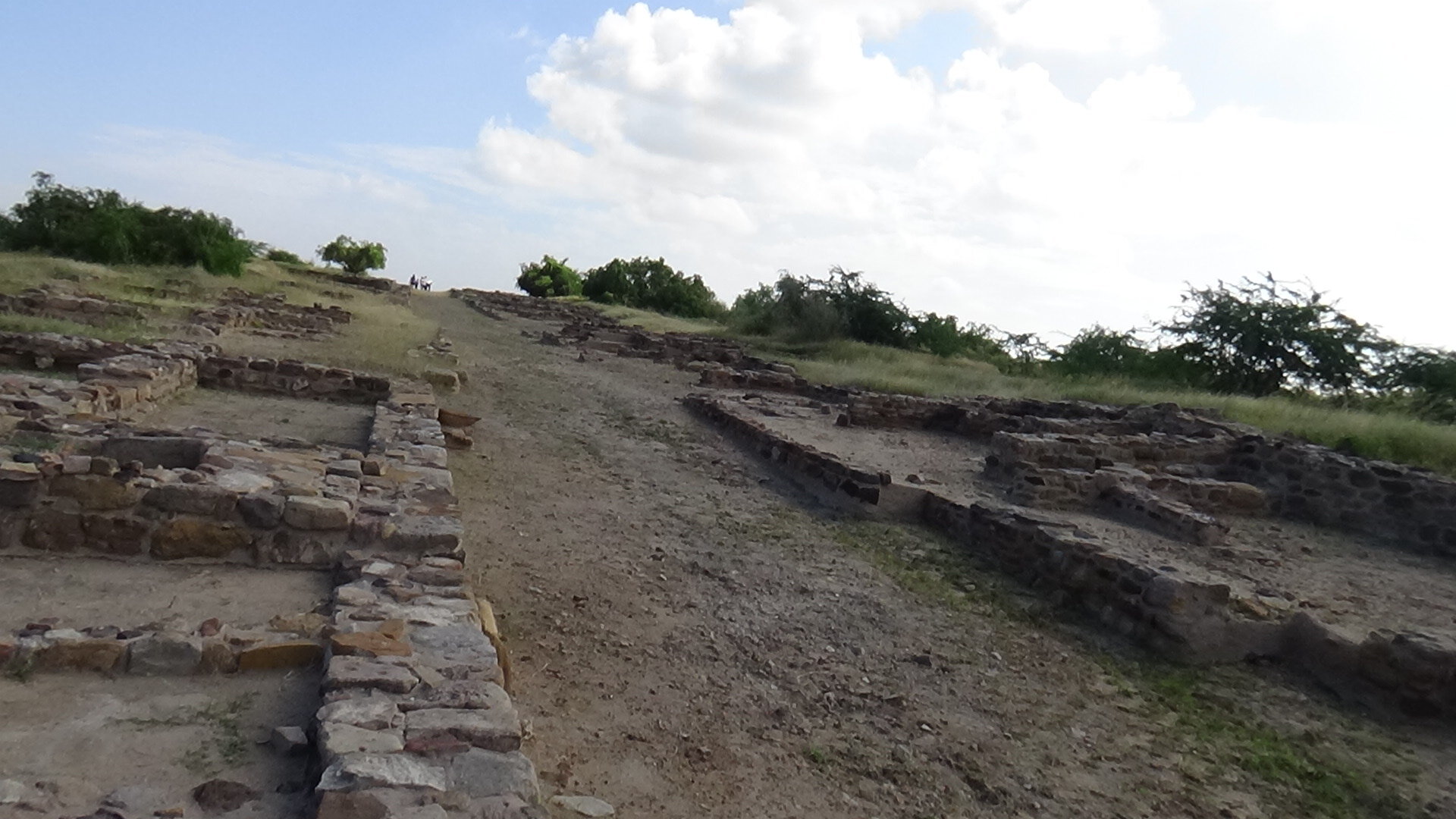
(xi)Why was there a need to have establish a fortified(three-tier) security in all these cities developed by the Sindhu people?
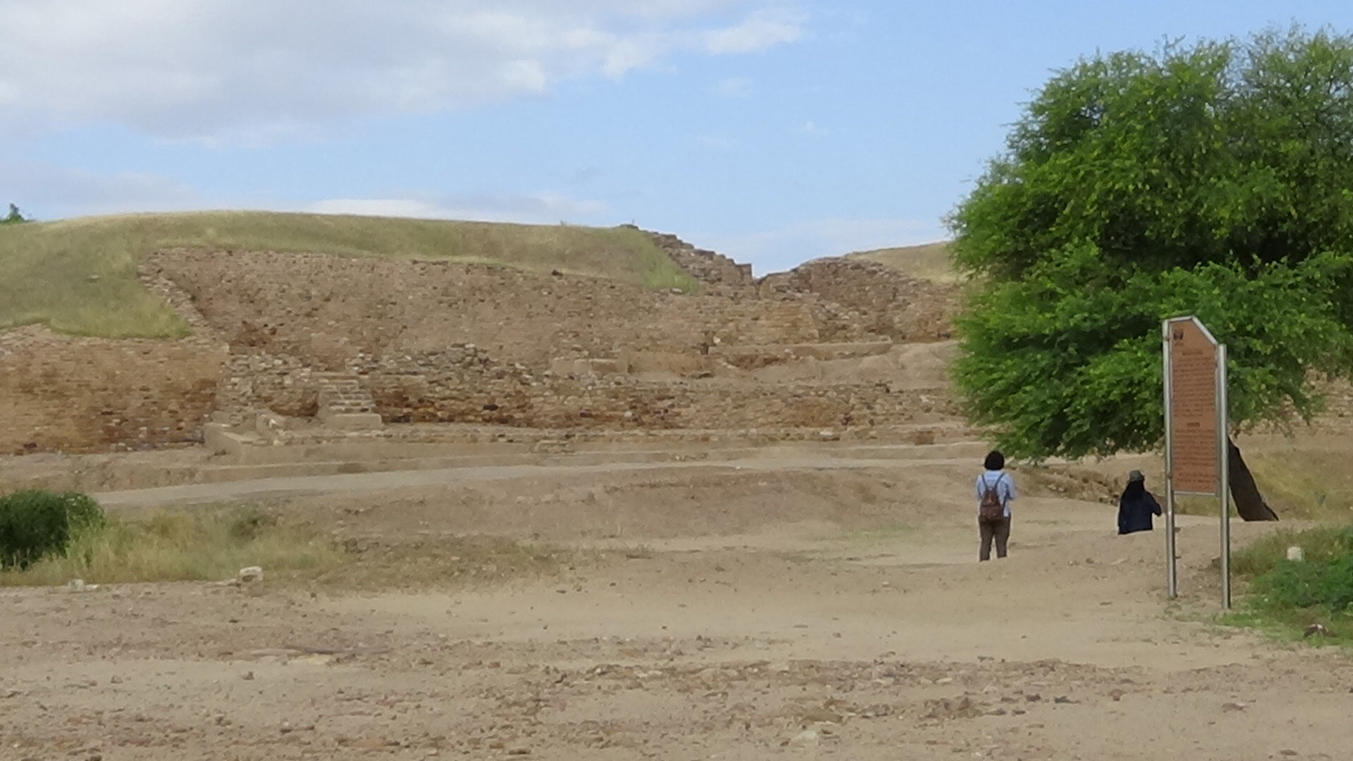
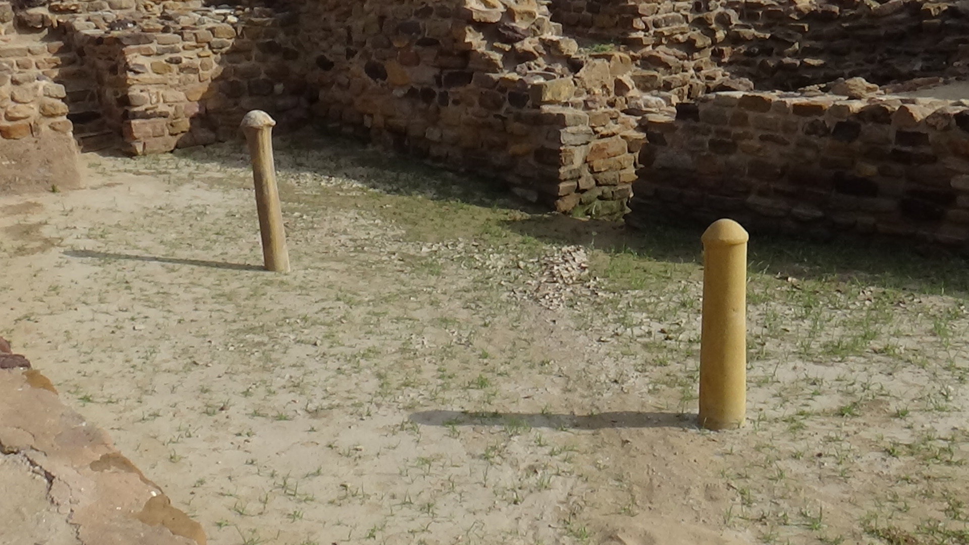
Fortified Eastern Gate at Dholavira
The Dholavira Mount with High Fortified Walls.
(xii) Is there any scientific evidence available that River Sarswati actually existed as a mighty river as described in the Vedas, and is not a mythological river?
(xiii)Is there any DNA evidence to prove that Sindhu – Saraswati people were not natives of this land? No there is no such proof, rather the DNA analysis report indicates that people who lived in Sindhu cities were our ancestors and we the modern Indians have the same DNA. Please read the Report by Prof VasantShindewho carried out the DNA study of a corpse found at Rakhigarhi.
http://chapter.intach.org/pdf/press-note-prof-vasant-shinde.pd
(xiv)Who invented this identity of the Dravid, when in Sanskrit it was used to describe only a region? Was it deliberate mischief to divide Bhartiyas and create a controversy or give rise to the non-existent Aryan-Dravid divide?
(xv)In view of the evidences that we have now about the geological changes that have taken place and some from remote sensing satellites, should we now not call this civilization as Sindhu-Saraswati civilisation or just Bhartiya civilisation?
(xvi)Why did the people living in these cities vanish in thin air leaving their ornaments, weighing equipments, toys etc?
(xvii)Our recorded history starts from Alexander’s invasion. So we do not know the sequence of events taking place in India prior to this invasion in 326 BC. So, how have we tried to fill this gap of 2000 years, extending from 326BC to 1900BC when people residing at Rakhigarhi, Dholaviraetc left their well-developed cities?
(xviii) If Rakhigarhi, Kalibangan and many other discovered cities, were located in the Sarswati basin or on the banks of it, and the Rig Veda also notes its presence, and the DNA of people who lived at Rakhigarhi and the current Indians, is similar then why should we be differentiating between Indus and Vedic civilization?
Answers One can think of .
Since the Sindhu script has not been entirely deciphered, a lot of questions remain unanswered and therefore, left to individual perceptions and of course politicization.
Notwithstanding political or ideological differences, there is now enough scientific evidence to prove that civilization on this subcontinent has had a continuous presence and there never was any invasion by the Aryans.
Then the question arises, why did the people inhabiting these cities leave?
Climatic Changes Caused Migration and Not Invasion by Aryans.
The Sindhu-Sarswati civilization, like any other civilization, had an early phase(3500BC- 2700BC), mature phase(2700 BC – 2000 BC) and the late phase(2000BC -1300BC).
This has been now an accepted fact that the people of these cities had to leave due to climatic changes and tectonic disturbances in Shivaliks, which caused the Saraswati River to dry. This has been covered in the book ‘The Lost River’ and is the subject of many research papers published by geologists and ISRO scientists. As the River started drying, over the course of many years, the inhabitants started shifting upwards.
This is not something unusual in the history of mankind.
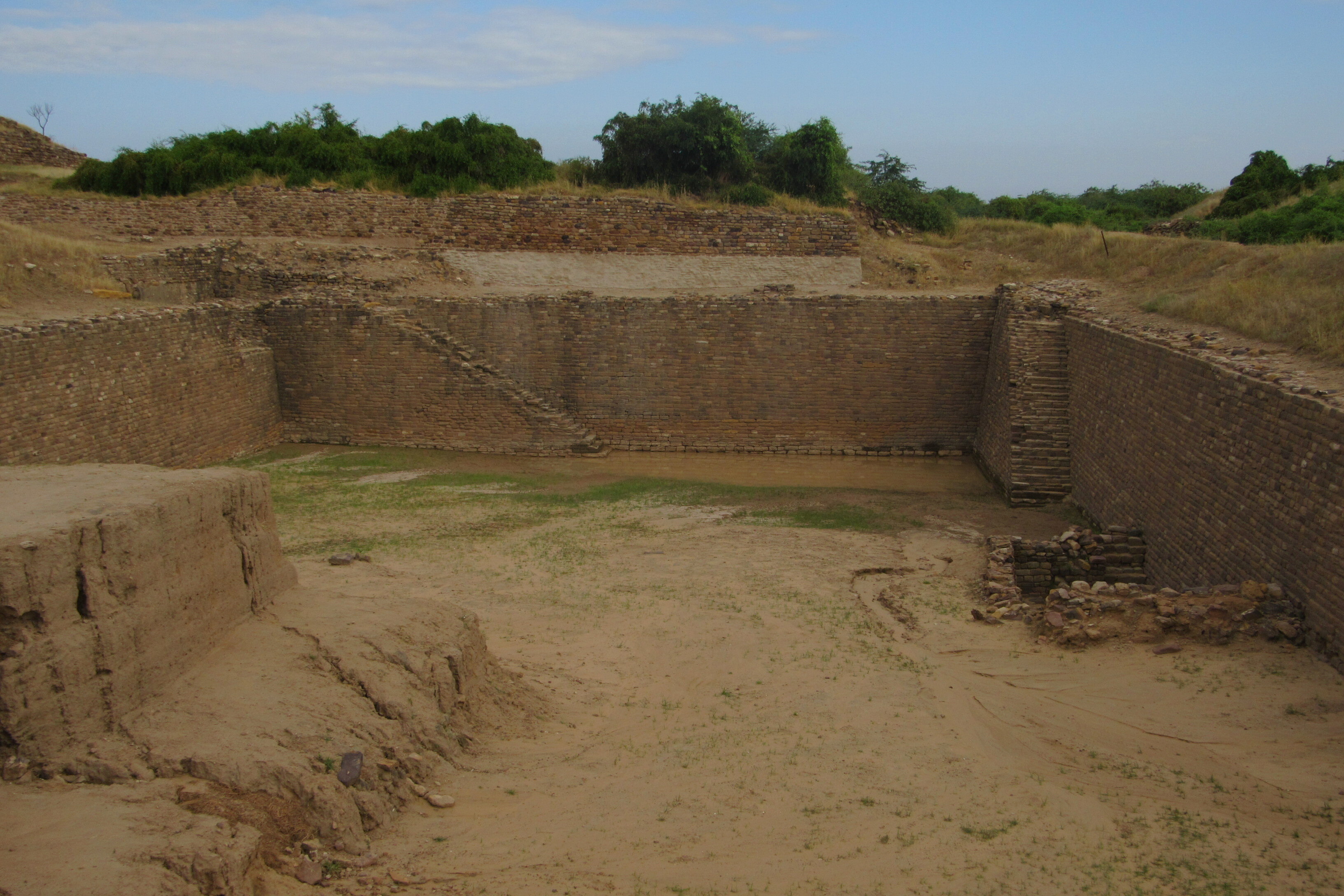
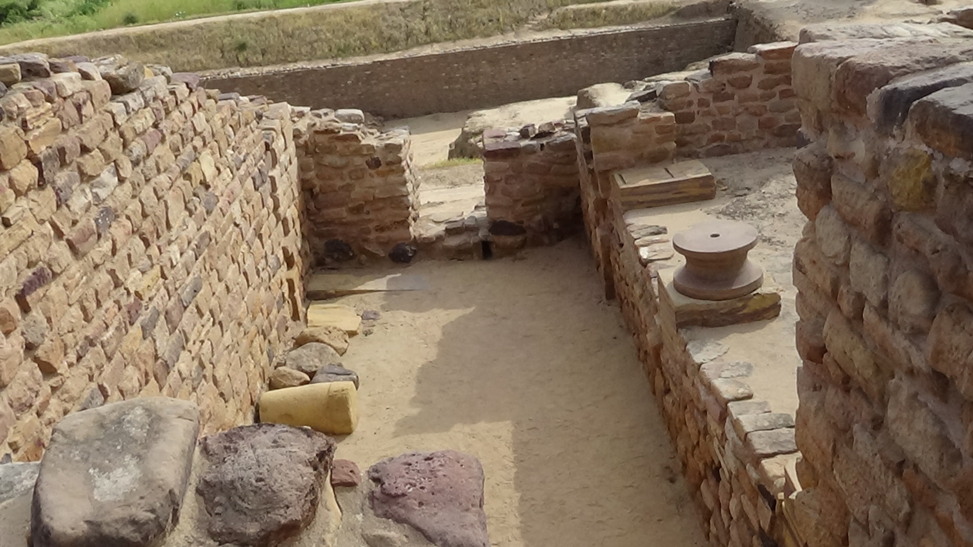
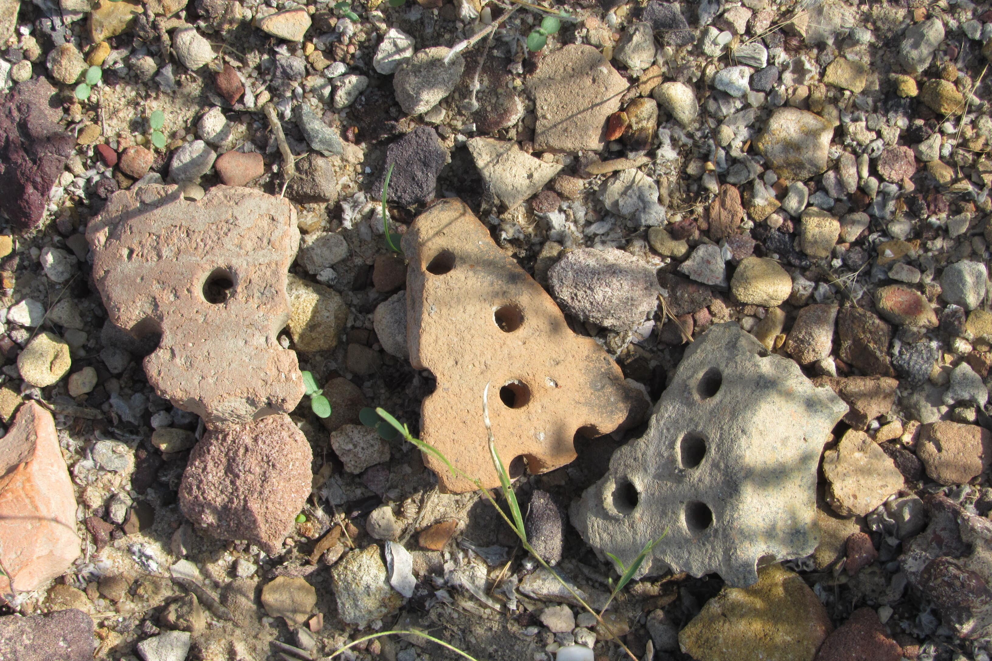
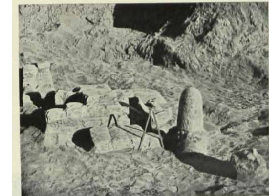
Many archaeologists have also suggested that besides the tectonic disturbances in the Himalayas, the environmental degradation must have also hastened the migration of people. The wood needed for furnaces for copper and bronze industry, bead ornaments, bricks and for cooking must have destroyed the local environment and caused soil erosion. At the Dholavira site, I could see remains of pottery and bones of animals, fish, chicken, cattle littered all over the place. This is indicative of how the whole city, over a period of 1000 years, must have gradually become unlivable.
Broken pottery pieces on the streets
Likewise, visit any Indian village in the evening and it becomes difficult to breathe because of the dust raised by returning cattle and the smoke from the kitchens of every household. The stench of cattle urination and excreta makes one cover the nose. Imagine how much pollution would a city, having a population of 24,000 crowded within an area of 771meters by 617meters, create. If we take a family size of six, then there would have been 4,000 dwellings and few bead making factories and copper factories. The city must have been a mess in the evenings.
Michael Danino in his book titled ‘The Lost River’ writes, “when we come to the late phase of Sindhu-Sarswati civilization, we see an extraordinary proliferation of settlements (160 in Punjab and 1,200 in Haryana alone) hugging the piedmonts of the Shivaliks, visibly clinging on to the last rain fed streams flowing down the hills, while not a single site in the central part of the Sarswati basin; the river’s wide bed further downstream must have been almost bereft of water.”
Furthermore, he writes, “in the early and mature phases of civilization the sites were crowded around Ghaggar, the Chauthang and other tributaries, they are also completely absent along the current courses of Yamuna and Sutlej (except in its upper reaches during the mature phase), is a confirmation that these rivers did not occupy their present beds when Sindhu- Sarswati civilization flourished”.
When one compares the location of sites/cities crowding around rivers in Early phase, mature phase and late phase, one can easily make out the shifting of population centers as well as the shifting of river beds.
Rural Vs Urban Argument.
Similarly, the argument that the Vedic people were rural and Sindhu were urban, does not stand to reason. Even today’s India, is an agro-urban society, whose 70 % population still resides in villages -dependant on agriculture and reveres cows - while at the same time it has some 10-15% population living in mega cities. It would therefore, be prudent to call the Sindhu-Sarswati civilization an agro-urban society. After all, to feed 20,000 residents of a city one needs almost 24,33,333 kg of wheat per year and 133 kgs rice per person per annum. So, for 20,000 residents -26,76,666kgs and to grow this much of grain one requires atleast 1,000 acres of land. i.e. approx. 4 square kilometers.
Prima facie, it appears that predominantly the cities of Rakhigarhi, Dholavira and Mohenjo-Daro etc were engaged in agriculture activity and the remaining few persons may have been artisans who were producing ornaments of shells, beads and pots. Or else those 20,000 persons might have been buying grains from the people who were residing outside the town. Is it really possible for a society 5,000 years ago to treat food producers as outsiders and keep them outside the boundaries of their cities? As such huge storage utencils have been found in the houses and even granaries were found.
One Indian historian wrote that after the collapse of Indus cities the material culture does not show continuity. However, this appears to be a sweeping statement.
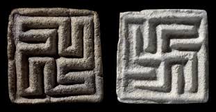
The most obvious of instances is the uninterrupted use of the Swastik symbol, found on an Indus valley era seal. It is used by the Indians today as an auspicious sign.
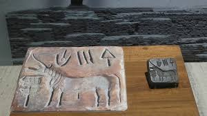
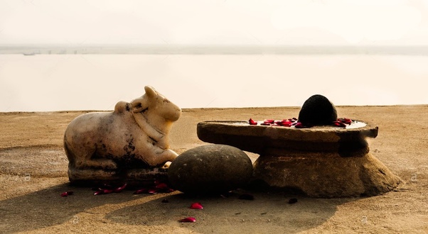
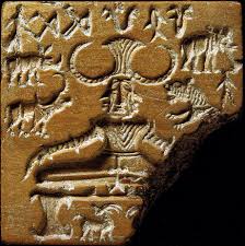
Secondly, the bull is still revered and Nandi bull adorns all the Shiva temples. Almost 75% of all seals found in these cities depicted a single horned bull facing a ritual stand. This could have been the Nandi facing the Shiva ling. As such few Shiv lings have been found at Kalibangan. Even the tablet depicting a man with horns and surrounded by animals can be the image of Pashupatinath, Shivji is often depicted in this manner.
The fortifications found in Dholavira and other Indus valley civilization cities appear to be similar to those found later in ancient cities of Kausambhi, Ujjain and Vaishali.
The obsession with ratios and dimensions of roads, and planning of cities can also be seen in Arthshastra written by Kautilya during the Mauryan rule in approx. 300 BC. At Dholavira, one can find this to be an amazing feature where the entire city is in the ratio of 5:4 (length of 771metersand width of617meters; the length 25% longer than the width). It did not end here; the planners applied the same in designing the lower town, middle town and citadel/castle areas of each and every city.There was evenstandardization in the dimensions of the bricks; in the 1:2:4 ratio.This obsession with precise dimensions is found in texts of later period -Vastushastra, Arthshastra and other treatises.
This obsession underpins the assertion of continuity of the Sindhu-Saraswati and Vedic concepts. Yes there may not be a 100% similarity as various norms and symbols underwent transformation over such a long period of time, but they have retained the quintessential features.
The Art of building Grand Palaces and Cities was not learnt in a day
Greek diplomat, traveler and historian Megasthenese, who visited Bharat during the Mauryan reign (c. 320–180 BCE) noted about Patliputra to be among the first cities in the world to have a highly efficient form of local self government. The city was estimated to have an area of 25.5 square kilometers, and was in the shape of a parallelogram and had 64 gates.
This must have followed from the creation, administration and governance practices of Rakhigarhi, Dholavira and Harappa. Even Mahabharata, which many of us dismiss as mythological, has talked about Janapads, which were perhaps self-governed units.
Aelian, a Greek writer described Indian palaces as superior in splendor to Persia's Susa or Ectabana. He remarked, "in the royal residences in India where the greatest of the kings of that country live, there are so many objects for admiration that neither Memnon’s city of Susa with all its extravagance, nor the magnificence of Ectabana is to be compared with them”.
Fahien, the Chinese traveler, said about the palace of Emperor Asoka, “it might have been built not by men but by gods”.
Mauryans could not have learnt building such magnificent palaces and cities on their own. If we,the modern men,have taken some 2,000 years to learn building multi-storied sky scrapers and huge mansions, then such impressive knowledge of city governance and building would not have come to the Mauryans in year or so. Perhaps, they were the same people who built cities like Rakhigarhi, Dholavira and Kalibangan.
There is another example which supports the continuity. The small town in district Farrukhabad in UP named Kampil. Kampil was believed by the locals as the famous capital city Kampilya of Panchal whose king was Dhrupad - father of Draupadi. Ruins of a fort in the city was also called by locals as Dhrupad Kila. Dr RS Bisht who was responsible for the excavations at Dholavira was surprised to find a similar orientation and dimensional similarity in the design of kila with Dholavira.
Therefore, as it appears prima facie, there has been continuity.
Scientific Evidence
There is a huge gap that exists in Indian history, of some 2000 years that needs to be filled. However, despite that large gap, it can be said with reasonable certainty that there has been cultural continuity i.e the Sindhu-Sarswati people were the same who later wrote the Vedas and the Upanishads because:
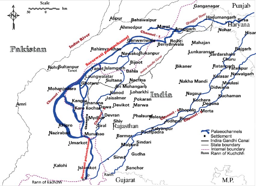
- It has been proven beyond doubt now that River Sarswati existed and cities Rakhigarhi, Kalibangan etc were situated in its basin. The Vedic River Sarasvati is a reality, attested by over 2,000 (80%) archaeological sites of the Saraswati-Sindhu civilization which was a riverine-maritime culture with seafaring merchants. This has also been confirmed by the scientists of ISRO, BARC and Geological survey of India. Unfortunately, the old school historians have either advertently or inadvertently missing the research work done by scientists. Scientists like JR Sharma and BK Bhadra of the Indian Space Research Organisation have proved, using the remote sensing technology that the Saraswati flowed through the Indian sub-continent.
Mr JR Sharma and BK Bhadra of ISRO’s Regional Remote Sensing Centre, Jodhpur, discovered the Paleochannels of the Vedic river using Remote Sensing and Global Information System techniques. In a paper published in International Journal of Remote Sensing Vol. 32, No. 18, 20 September 2011, 5197–5216, they mentioned about the work he and Mr Sharma did to prove the existence of Saraswati;
“Data from the Indian Remote Sensing Satellite was used to delineate the buried Paleo-channels through image processing techniques in parts of Haryana, Punjab, Rajasthan and Gujarat. The discovered river course has been validated with ground information like historical maps, archaeological sites, hydrogeology, sedimentology, drilling (litholog) and geochronological data,”
“Drilling of tube wells on the Paleo-channels shows the availability of large quantity of potable water which may be tapped as groundwater source in the water striven Thar desert,” said Mr Bhadra. SM Rao and KM Kulkarni, two senior scientists of the Isotope Chemistry Division of the BARC too proved by radio isotope studies that there was a river which flowed through the Indian sub-continent about 10,000 years ago. Along with AK Gupta and G Sreenivasan, their colleagues in RRSC, Mr Sharma and MrBhadra have found that the river disappeared in approx. 3,000 BC due to climatic and tectonic changes.
A channel that is no longer part of an active river system and has ceased to be a conduit of water is commonly referred to as a Paleo-channel. It occurs when rivers change their course either due to the movement of tectonic plates or severe floods and cut new ones. Some of the Paleo-channels lie buried under younger sediments and are commonly occurring landforms in alluvial landscapes. They have an economic significance because of their use in the exploration for freshwater resources, artificial recharge and storage of groundwater.
Another group of scientists SM Ramaswamy of School of Earth Sciences, PC Bakliwal and RP Verma of Geological survey of India, Photogeology and Remote sensing division in their paper titled - Remote sensing and river migration in western India” published in international journal of remote sensing in 1991wrote; “Theexistenceofanextinctmightyriverin theTharDesertregioniswellknowntothe indigenous people. Many workers havepresented evidence in the form of the occurrence of isolated Paleo-channels (PCs), sweet water and good yields from the wells drilled along them, archaeological artefacts, channel-like anomalies on aerial photographs andsatellites images and have tried to suggest the course of the river based mostly on limited evidence”.
These scientists have used remote sensing satellite images and interpreted present day drainage systems. The paper states that the occurrence of well developed tentacles of Paleo-channels in the vast desert area and the final arm of the Paleo-channel of River Ghagar in the Anupgarh-Ganganagar plains show that river Sarswati flowed close to the Aravali range, met the Arabian Sea in the Rann of Kutch. It gradually drifted to the north-west and the north, finally buried in the northern edge of the Thar desert as the Ghagar river.
The ONGC (Oil and Ntural gas corporation) with an intention of finding oil in deserts near Jaisalmer, Tanot carried out drilling and found water at a depth of 555 m near Jaisalmer (Rajasthan) which could be taken out at the rate of 76000 litres per hour,and it was hardly saline .
BARC also announced similar discoveries after the Nuclear tests that India conducted in 1999. The water underneath was potable, drinkable, sweet it matched with the Himalayan glaciers waters.
Another report of the expert committee appointed by the Govt to review the Paleo-Channels Of North West India said ;
“ Applying various geophysical methods of underground mapping, analyzing hundreds of well logs and pertinent data and interpreting satellite imageries, recent workers have demonstrated existence of under-surface sand bodies of palaeochannel systems (adjacent to the Harappan sites). These aquifer bodies represent the past courses of large rivers originating in the Himalaya – one flowing in the period 20 to 15 ka and the other 6 to 3 ka in northern Haryana. The Ghaggar of this region occupies the former course of the Satluj River and the hydraulically related Markanda and Sarsuti rivulets etc. were connected to the palaeo-Yamuna River. Recent studies have identified sediments deposited in the Ghaggar-Hakrapalaeochannel that were sourced from the Yamuna and Satluj catchments. The strontium ratios and neodymium ratios of the constituents of the Ghaggar sediments in the northern Haryana and in the SirsaKalibangan reach in the west unequivocally demonstrate that the sediments of the buried channels were derived from the Great (Higher) Himalaya as well as from the Lesser Himalaya. In the Hakra reach, where among hundreds of settlements, the largest city of the Harappan civilization, Ganweriwala was located, the buried palaeochannel yielded potable water dated 12,900 years BP to 4700 BP. Likewise the Paleo-channels in the Jaisalmer area have been supplying potable water. The water in the depth range of 30 to 50 m being 1800 to 5000 years old and in the 60 to 250 m deep aquifers 6000 to 22000 years old.”
The report further states that ‘ On the banks of this Ghaggar at Sirsa stands an ancient fort named Sarsuti, the name recalling the rivulet Sarsuti that joins the Ghaggar at Pehowa in Kurukshetra district. Presumably, the fort represents a tribute to the importance of the rivulet Sarsuti, a corruption of the name, Saraswati. The name Saraswati is ingrained in the perception of the people and the Government revenue records show the river Saraswati extending from Adibadri in the Siwalik foothills to Pehowa and beyond.
The expert committee report states that – “ Investigations have revealed that more than one river were involved in building up the deltaic deposits in the Great Rann. This delta is characterized by strikingly uneven topography, marked by areas of higher grounds (bet of river borne sandy and silty sediments) and depression or distributary channels. The digital image processing of IRS-P6 AWiFS and Radarsat SAR images reveals a pattern of deltaic drainage pattern called the Bird’s Foot type comprising complex intertwined channels. This structure was formed in the past by huge sediment discharge of what is believed to be the Saraswati River within marshy land of Great Rann of Kachchh. Significantly, these Paleo-channels can be traced upto the Gulf of Kachchh. “ Does it tell us what Rigved hymn said ; the river Sarswati ends in Samudr”
Central Ground Water Board had constructed more than 30 exploratory wells along the Paleo-channels of Ghaggar-Hakra extending over the states of Hyarana, Rajasthan and Gujarat in order to map and characterize the aquifers existing within the Paleo-channels. Ground water explorationGround water exploration carried out in the Paleo-channels of Rajasthan recorded high discharge of upto 1000 lpm with comparatively good quality ground water.
The information on ground water level along the Paleo-channels is obtained from exploratory wells drilled by CGWB. The water level ranges from 15 to 37 m below ground level (bgl) in parts of Haryana, 30 m bgl to 60 m bgl in Paleo-channels of Rajasthan and more than 90 m bgl in parts of Gujarat.
There is also a report prepared by the K.S. Valdiya Committee under the Ministry of JalShakti.The report is based on the study of the land texture, piles of sediments, shapes, and features of states of North-West India including- Rajasthan, Haryana, and Punjab. The salient aspects of the report are as follows ;
- The found sediments are reminiscent of ones found in present-day Ghaggar, Ganga, and the Yamuna.
- River Saraswati originated from Adibadri in Himalaya and culminated in the Arabian Sea through the Runn of Kutch.
- The report also states that the river once upon a time was the lifeline of the North-Western states of India.
https://www.rajras.in/saraswati-river-exist-says-k-s-valdiya-committee/
If as per the scientific evidence River Sarswati had dried up or in the process of drying up in 1900 BC then who wrote Rigved hymns on Sarswati and who created cities on the banks of river Sarswati. If the Saraswati was flowing strong from the hills to the sea during the Rigvedic times, the later literature clearly mentions about the drying up of the Saraswati. Vinashana is the place where it disappeared in the sand as mentioned in Panchavimsa Brahmana.
JM Kenoyer one of the world's leading authorities on the ancient Indus civilization. A Professor of Anthropology at the University of Wisconsin Madison, has been excavating with the Harappa Archaeological Research Project (HARP) at the ancient Indus city of Harappa for since 1986 remarked ; if the ancient sarswati had totally dried up in and around 1900 BCE and if many episodes of Rig Ved took place along sacred sarswati , does it not follow that that the episodes took place before the end of Indus valley civilization, while the river was flowing.?
But the dates given to Aryans for having crossed Indus and settling down here was approx. 1400 BC so how did they write Rig ved hymns along sacred sarswati. Calling it great mother, goddess and so on in its praise. We are given to believe by some of these historians that Aryans crossed mighty Indus and its four tributaries and then settled down along a dry Sarswati.
Is it plausible.?
No, it is not.
How have this anamoly occurred? It has occurred because the historians who propagated the Invasion theory had given dates ; 1500 BC to 1000 BC. Now with the scientific evidence of DNA and Sarswati existence is available they have to either change the dates of invasion and make it 2500 BC to 2000 BC, but that is also not plausible because that was the period when SINDHU- SARSWATI civilization was at its peak ; it was the mature phase.
So what would they do now ; Yes they can still continue to cook up and concoct any stories to justify their belief and still discount all scientific evidences.
Dr. Louis Flam, another noted archaeologist rightly remarked and this we common men can easily observe around us;
Dryingup of a Stream or a water body is not a single event phenomena occurring over a short period of time. I noticed this phenomena in Indore where a seasonal pond spread over two acres fills up in monsoons and over the next few months it dries up. The whole pond does not dry up simultaneously but it does gradually forming several smaller pools / ponds in that area before finally drying up in Jun. Thus, we will find such numerous pools/ ponds/lakes along the whole course of River Sarswatiwhich are still getting water from the palaeochannels underneath. Those places are still being revered by Indians, thousands of pilgrims visit these places in Haryana, Rajasthan and all of them are named as Sarswati.
In addition to all this , Mr Michel Danino, a noted archeologist and an author, originally from France has written a wonderful research account in his book - The Lost River: On The Trail of the Sarasvati, suggesting that the river originated from Shivalik hills and joined Arabian sea in the Rann of Kutch.
Two. The DNA report study published in 2020 which clearly stated that Modern Bharatwaasi had its ancestors living in Rakhigarhi.
Please refer to the Archaeological and anthropological studies on the Harappan cemetery of Rakhigarhi, India by Prof Vasant Shinde who was responsible for the DNA analysis of the corpses found in Rakhigarhi, a Sindhu- Sarswati Valley site bigger than Mohenjo-Daro.
https://journals.plos.org/plosone/article?id=10.1371/journal.pone.0192299
Jean Marie Casal a French archaeologist, who had specialized in the study of the Indus culturesaid – until now Aryans have eluded all archeological definitions ,so far no type of artefact, no class of pottery, has been discovered that would enable us to say ; Aryans came this way ; here is a typically Aryan sword or goblet.
Aryans Were Not A Race But a Tribe.
And these squint eyed scholars are viewing this question with political bias, as a racial issue rather than a mere tribe. Arya were not a race but a tribe and if Europe could have 66 tribes ; Vikings, Saxons, Gaulic etc. so BHARAT, a huge subcontinent would have also had numerous tribes residing here.
Our civilization is absolutely indigenous and instead of now dividing it into SINDHU- SARSWATI and Vedic, it must simply be called as BHARATAM CIVILISATION.
If these few historians still continue, to undermine and negate these scientific evidences and propagate this theory of Aryan invasion without any substantial evidence, they are free to do so, atleast the people are not going to believe their theory anymore.
They can keep raising such stupid questions as furnished below ;
Read ; 4500-year-old DNA from Rakhigarhi reveals evidence that will unsettle Hindutva nationalists by Kai Friese in INDIA TODAY.
& Mythologist Devdutt Pattanaik tweeted that people would now go to the extent of saying that “there was no Muslim invasion” and “British Raj” ever.
Lastly, let’s not close our minds and look at the whole thing with a new perspective…
One. Some tribes might have moved from East to West also instead of just one way West to East as we have been told.
Two. Is it not possible that after having faced the challenges of city life 5000 years ago the people might have given up an idea of setting such mega cities due to environmental causes.
Three. Post Saraswati drying up, the cities that those Bhartiyas set up along Ganges, Yamuna, Shipra, Narmada, Godavri, Tungbhadra subsequently; Varanasi, Patliputra, Nasik, Ujjaiyini and so on, never needed to be abandoned and so these urban centers continued to develop. For instance, Ancient Nasik in 100 BC was considered as one of the largest market places and is still a prominent city of Maharashtra.
Xxxxxxxxxxxxxxxxxxxxxxxxxxxxxxxxxxxxxxxxxxxxxxxxxxxxxxxxxxxxx